Meteorologists are closely monitoring a series of fast-developing weather systems threatening parts of the southeastern United States and the Caribbean. Over the past 48 hours, satellite data from the National Hurricane Center (NHC) and NOAA has shown a surge in tropical activity that could bring heavy rain, flooding, and severe coastal conditions to multiple regions.
Forecasters say a new disturbance near the southeastern U.S. coast shows signs of early organization, and could evolve into a tropical depression within the next few days. The system, driven by warm ocean temperatures and a strong moisture feed from the Gulf, is already producing heavy downpours along portions of Florida, Georgia, and the Carolinas. Residents in low-lying and coastal areas are being advised to remain alert for flash flood watches and potential evacuation guidance later in the week.
At the same time, Central America is reeling from extreme rainfall that has caused severe flooding and landslides across parts of Honduras, Nicaragua, and Costa Rica. Some communities have recorded more than 300 millimeters of rain in less than 72 hours, forcing evacuations and damaging infrastructure. Emergency crews are working around the clock to restore power and clear blocked roads, while local governments urge people to avoid traveling in mountainous regions where the soil remains dangerously unstable.
Farther east, seismic monitors have confirmed a moderate earthquake near Trinidad and Tobago, adding to the sense of unease in the region. The 5.6-magnitude quake struck just off the coast early Tuesday morning, shaking homes but causing no major structural damage or injuries, according to early reports from local authorities. Still, it served as a reminder of how unpredictable and interconnected natural forces can be in this part of the world.
Adding to the chaos, thick Saharan dust has been sweeping across the Atlantic, blanketing parts of the Caribbean from Puerto Rico to Jamaica in a hazy film. The phenomenon, while common during this time of year, has been unusually dense. Meteorologists note that these dust plumes can suppress hurricane development temporarily by drying out the atmosphere, but they also worsen air quality, posing health risks for people with respiratory conditions. Health officials are urging residents to stay indoors when possible and use air filters or masks to reduce exposure.
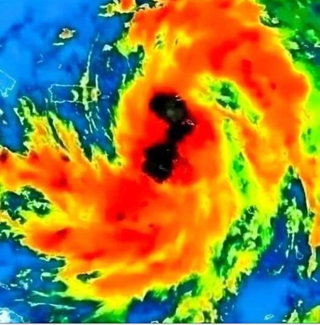
Meanwhile, another tropical disturbance—currently being tracked near the open waters east of the Lesser Antilles—has been labeled “Invest 92L.” Early computer models suggest it could develop into Tropical Storm Flossie if conditions remain favorable. Wind shear in the region is relatively low, and sea surface temperatures are well above average, providing ample fuel for storm formation. If it strengthens as predicted, Flossie could move west-northwest toward the Bahamas or the southeastern United States by the weekend.
Meteorologist Dr. Karen Morales of the NHC says the pattern forming now is “a classic setup for late-season tropical development.” Warm water, persistent moisture, and stalled atmospheric boundaries are combining to create an unstable environment across the region. “People see that the hurricane season is technically ending soon, but nature doesn’t care about the calendar,” Morales said. “Conditions remain favorable, and we urge everyone to stay informed.”
Authorities across the affected areas are coordinating preparations, reviewing flood-response protocols, and reminding residents to have emergency kits ready—flashlights, batteries, bottled water, and medication supplies for at least three days. Coastal communities from Savannah to Miami are advised to monitor local forecasts, as minor storm surges and dangerous rip currents may accompany the incoming weather system even if it doesn’t reach full tropical-storm strength.
With flooding in Central America, dust storms over the Caribbean, seismic activity near Trinidad, and potential tropical development along the U.S. coast, the week has become a sobering example of how quickly environmental conditions can compound. Experts emphasize that while each event is separate, their overlapping effects—disrupted travel, strained emergency services, and increased health risks—underscore the importance of preparation and awareness.
For now, residents across the southeastern United States and nearby regions are being urged to stay alert, avoid unnecessary travel in flood-prone areas, and check official updates from the National Weather Service. As the systems evolve, meteorologists will continue to track and model their paths closely.
Nature is reminding everyone, once again, that even late in the season, the tropics still hold the power to surprise.